Mississippi Map

Facebook Twitter Google+
Follow The Go Travel Sites on Facebook

  • Places To Go

    Explore travel information for Mississippi cities, towns, parks, regions and more.

    Coverage for every state in the United States.

    Explore neighboring countries (and soon countries throughout the world).

    Columbus

    Ohio's capital, Columbus, is the flourishing home of Ohio State University, a number of state parks, a clutch of cultural sights and German Village, a red-brick neighborhood with old-World charms.

  • Things To Do

    Introduction to all the things to do in Mississippi.

    Searchable list of tour companies, guides and outfitters, rental companies and more.

    Full information on Tourist Attractions, Scenic Drives, Sightseeing Tours and easy vacation activities..

    Detailed information on active pursuits such as biking, hiking, golfing and much more.

    Museums, parks, galleries, zoos, and everything else you could want to do in Mississippi.

    Things To Do

    Mississippi has a diversionary range of attractions, from museums to river scenery, historic sites to petrified forest, balmy beaches and the occasional Elvis sighting.

    Learn More
  • Sleep + Eat

    Searchable listings of Mississippi hotels, motels, resorts, bed & breakfast, and more.

    Searchable listings of Mississippi RV parks and campgrounds.

    Lodging and Hotels

    Use our easy Lodging Search to find exactly the type of accommodation you are looking for at the right price.

    Search Now
  • Travel Planning

    Request Free Travel brochures from destinations throughout Mississippi.

    Transportation companies, airports and interactive maps for Mississippi.

    Travel and tourism books and maps for Mississippi.

    Basic facts about Mississippi, including a guide to every city and town in Mississippi.

    Searchable lists of Mississippi tourism offices and other helpful government agencies.

  • Photo Gallery

    Searchable slide shows of Mississippi photos.

    Searchable slide shows of Mississippi videos.

    Photo and Video Gallery

    Browse photos and videos from across the state, take a virtual tour, search for the imagery you want to see.

    View Now
  • Map It!

Grand Gulf - Raymond Scenic Byway

No Media or Maps Available
If you are the owner/manager of this business and would like to improve your listing, please submit a request.
Basics
Length:
50 miles (80 km)
Time:
2 hours

Description

Visitors come to this byway for a leisurely step back in time among an enjoyable atmosphere. Delve into Mississippi's history, explore the lush countryside, or imagine men in arms as they marched along the byway years ago. The fifty-mile byway stretches from northern Claiborne County all the way to western Hinds County and offers a fresh look at an environment untouched by modern development.

Begin your sightseeing in Port Gibson at the Grand Gulf Military Monument along Back Grand-Gulf Road. Port Gibson stands as one of Mississippi's oldest remaining towns to have withstood the impacts of the Civil War. The town's Grand Gulf Military Park includes important artifacts from Civil War battles including muskets, uniforms, and cannonballs. The park can help gaining a better perspective of why this byway is so historically significant.

As the byway continues through Mississippi it ends in Raymond. Once devastated by the Civil War, Raymond is now an informational area to learn about a crucial part of America's history. Watch Civil War reenactments or visit the area where the Battle of Raymond took place. Trace your heritage and learn of the many challenges that settlers, Indians, and missionaries faced. Raymond offers a two-week Annual Pilgrimage that visits the Hinds County Courthouse, historic homes in the community, and the Raymond Cemetery.

Tourism Resources

Attractions

Points of Interest Along The Way

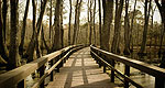
Delta National Forest (MS)

The Delta National Forest consists of over 60,000 acres of marshy wetlands in Mississippi. The forest plays an important role in protecting the American Waterfowl by providing an area for the birds to reside and migrate.

Directions

In Port Gibson, go north on U.S. 61 to Vicksburg, then north on SR 3.

Homochitto National Forest (MS)

The Homochitto purchase unit was established in 1936 as the first National Forest in Mississippi. The Forest was named for the Homochitto River, an Indian name for Big Red River. France, England, Spain, and the United States strongly influenced the area of land around what is now the Homochitto National Forest. It operated as a single district until 1952, then was divided into two Ranger Districts, the Bude and the Homochitto.

The Forest, consisting of approximately 189,000 acres, hosts a number of resources. The Homochitto is one of the leading timber-producing National Forests in the South. For nearly 50 years, exploration for oil and gas has taken place on this Forest. About 86 percent of the producing wells on National Forest land in Mississippi come from the Homochitto.

Directions

From Port Gibson, take U.S. 61 south, then SR 28 east.

Length:
50 miles (80 km)
Time:
2 hours
Main Roads:
MS-18 E
Customizable Directions

Formatted DirectionsMap
Mississippi Jackson Houseboating.org-Skyscraper-Space-Available

Email Page Link

Complete the form below to email this page to a friend or family member's email. You can send yourself an email as well. Your email and your recipient's email will NOT be shared with anyone. See our full Privacy Policy for details.
:
:
:


:
Copy Yourself on the Email Yes No
:
: